Rilievi Smart is a complex service management of the observations made in the territory, it does not include costs and facilitates the transmission and sharing of information. Necessary instrument to make it all work is our smartphone which we use every day. We can then extend its functionality in order to streamline the relevant processes and processing of geo-localized information.
Rilievi Smart consists of two websites (RilieviSmart), one for the management of Topographical Surveys and the other for the management of road surveys.
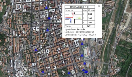
Through these websites, you can manage all phases of a relief, from the collection of the information field to the reporting in both tabular format that visually maps of geo-localized. In addition, another highlight of the two systems is the ability to simultaneously process information from multiple providers that collect data for the same relief.


(SMARTPHONE, APP, WEB SERVICE, EXCEL)